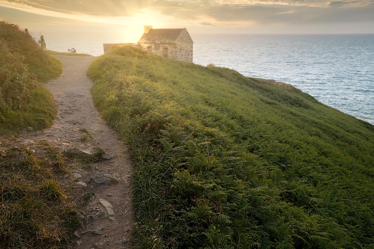
Why Walk the GR34 Coastal Path?
If you’ve ever looked at a map of France and traced the jagged outline of Brittany with your finger, you’ve already walked the GR34 in your imagination. The real thing is better: a sometimes-easy, sometimes-demanding trail that never strays far from the Atlantic. Here’s why it deserves to be your next big trip:
- Unbroken coastal drama: The GR34 rarely leaves the sea. You’re walking between heather and gorse, with one eye on the tide and the other on distant lighthouses.
- Manageable in legs: You don’t have to do all 2,000 km. The best-known stretches – from Mont-Saint-Michel down to the Gulf of Morbihan – can be split into 7–14 legs depending on your time and fitness.
- Villages, not wilderness (in a good way): You end most days in a fishing port or small town: a hot shower, a bowl of cotriade (Breton fish stew), perhaps a cider, then back to the cliffs in the morning.
- Family-friendly options: Many sections near Saint-Malo, Dinard, Concarneau, and the Gulf of Morbihan are flat and well-maintained, perfect for kids and casual walkers.
- Romantic and remote: The Pink Granite Coast, Crozon Peninsula, and Cap Sizun offer big, cinematic landscapes that feel made for slow, hand-in-hand walking.
- Cultural depth: Chapels balanced on headlands, calvaries in tiny hamlets, Breton language on road signs, and a musical calendar that runs on fest-noz (night festivals) and sea shanties.
In 2026, the GR34 remains one of Europe’s most beloved coastal routes, but if you plan smartly, you can still have long stretches almost to yourself, especially outside school holidays.
Table of Contents
- Overview: How the GR34 Coastal Path Unfolds
- Choosing Your Itinerary: 7–14 Legs of the GR34
- Leg 1: Mont-Saint-Michel to Cancale – Where Pilgrims Meet the Sea
- Leg 2: Cancale to Saint-Malo & Dinard – Corsairs, Ramparts, and Tidal Spectacle
- Leg 3: Saint-Lunaire to Cap Fréhel – Clifftop Wildflowers and Storybook Forts
- Leg 4: Paimpol to Ploumanac’h – The Pink Granite Coast at Its Best
- Leg 5: Ploumanac’h to Roscoff – Islands, Chapels, and Quiet Harbours
- Leg 6: Roscoff to Crozon Peninsula – Into the Wild Finistère
- Leg 7: Crozon to Pointe du Raz – Edge-of-the-World Walking
- Leg 8: Pointe du Raz to Concarneau – Surf Beaches and Walled Towns
- Leg 9: Concarneau to Quiberon – Riviera Light and Fishing Heritage
- Leg 10: Quiberon to Gulf of Morbihan – Islands, Standing Stones, and Soft Shores
- Eating & Sleeping Along the GR34
- Evenings on the Trail: Nightlife, Quiet Towns, and Starry Camps
- Day Trips and Nearby Attractions
- Cultural Etiquette & Local Customs
- Route Logistics & Practical Travel Advice (2026–2027)
- Major Events & Festivals 2026–2027
- Summary & Final Recommendations
Overview: How the GR34 Coastal Path Unfolds
The GR34 traces almost the entire Breton coastline, from the Mont-Saint-Michel bay on the Normandy–Brittany border to the Loire estuary near Saint-Nazaire. The classic stretch that most walkers tackle in chunks runs roughly from Mont-Saint-Michel to the Gulf of Morbihan.
In broad strokes, here’s how it feels, west to south:
- Emerald Coast (Côte d’Émeraude): Mont-Saint-Michel, Cancale, Saint-Malo, Dinard, Cap Fréhel. Think tidal drama, fortifications, and luminous light.
- Goëlo and Pink Granite (Côte de Granit Rose): Paimpol, Plougrescant, Perros-Guirec, Ploumanac’h. Wild coves, photogenic rocks, lazy harbours.
- North Finistère: Roscoff, Île de Batz views, Aber Wrac’h, the lighthouse coast. Remote, wind-sculpted, deeply “Breton”.
- Crozon & Western Finistère: Peninsula loops, Pointe de Pen-Hir, Pointe du Raz. The dramatic “ends of the earth”.
- South Finistère & Cornouaille: Surf beaches, Quimper’s spires, the painterly light that drew Gauguin.
- South Coast & Morbihan: Quiberon, Carnac, the enclosed sea of the Gulf of Morbihan, dotted with islands and megaliths.
I tend to walk it in this order (north to south-west to south) because the landscapes grow progressively wilder and then soften again, like a symphony easing back to calm.
Choosing Your Itinerary: 7–14 Legs of the GR34
Because people often ask for a “7 leg itinerary for GR34 Coastal Path” or a “10 legs of GR34 Coastal Path”, I’ve structured this as a 10-leg itinerary that can be compressed or stretched:
- Short on time? Combine Legs 1–2, 3–4, 8–9 to create a 7-leg itinerary for GR34 Coastal Path.
- Want deeper immersion? Split my longer legs into two each, giving you a 14 leg itinerary for GR34 Coastal Path.
- Middle ground: Turn my 10 legs into an 11, 12, or 13 leg itinerary for GR34 Coastal Path by adding rest days in Saint-Malo, Perros-Guirec, Crozon, or Quiberon.
Each leg below is 1–2 days of actual walking, depending on your pace and how many detours you indulge in. I’ll highlight the best places to visit on the GR34 Coastal Path, plus local food, hidden gems, and honest travel tips for GR34 Coastal Path that come from repeatedly getting my socks soaked by the tide.
Leg 1: Mont-Saint-Michel to Cancale – Where Pilgrims Meet the Sea
I like to begin with the silhouette of Mont-Saint-Michel in my rear-view mirror, because it sets the tone: this is a walk along a coastline that has always been sacred to someone – monks, fishermen, customs officers, and now, us walkers.
Route Snapshot
Distance: ~35–40 km, best spread over 2 days. Difficulty: Easy to moderate, mostly flat coastal paths and small roads. Best for: First-timers, families, anyone who wants big skies without big climbs.
From Mont-Saint-Michel: Starting at the Edge of Sand and Sky
On my last spring visit (May 2026), I caught the 08:00 shuttle from the Mont-Saint-Michel parking and walked part of the causeway at low tide. The bay was a shimmering sheet of silver, with walkers in the distance doing the barefoot guided crossing. For the GR34, you’ll officially pick up the red-and-white blazes near the access bridge on the Breton side.
I always suggest spending the night before in the bay area, not on the Mount itself (which is magical but relentlessly crowded). The small villages like Roz-sur-Couesnon and Saint-Marcan give you quieter dawn views. In 2026, a couple of new B&Bs have opened with direct GR34 access – ask locally, as they often don’t appear on big booking sites right away.
Walking the Bay: Polders and Panoramas
Leaving the Mont behind, the GR34 follows raised paths along the polders – reclaimed land used for grazing. It’s not the most dramatic scenery of the entire trail, but it’s quietly magnificent: sheep dotted like salt on the grass, the Mount slowly shrinking yet still hovering in your peripheral vision.
Tip: The wind can be fierce even when the forecast says “mild”. Pack a light windbreaker and something to cover your ears, especially in shoulder seasons.
Dol-de-Bretagne Detour: Medieval Heartland
Strictly, the GR34 hugs the coast, but I often recommend a short detour inland by bus or taxi to Dol-de-Bretagne if you have an extra half-day. The cathedral square is one of my favourite spots for a mid-morning coffee; the bakery on the corner does a sea-salt caramel kouign-amann that will ruin you for all future pastries.
Approaching Cancale: Oyster Beds and Tidal Rhythms
The closer you get to Cancale, the more you’ll see the patchwork of oyster beds revealed at low tide. I remember arriving one early summer evening, the tide out, the sun low, the metallic glint of the rails and crates criss-crossing the bay. It felt like stumbling onto a secret industrial landscape that disappears twice a day.
Eating in Cancale: Oysters on the Sea Wall
There are two Cancales: the postcard harbour of La Houle below and the upper town above. For walkers, the lower town is where you want to be. The GR34 passes right along the seafront, and you’ll see the informal line of oyster stalls on the sea wall, selling by the dozen.
- Budget feast: Buy a dozen numéro 3 oysters and a wedge of lemon, then sit on the sea wall, legs dangling, tossing shells back into the bay like the locals.
- Splurge: Book ahead at a harbourfront restaurant such as those around the western end of the quay. In 2026, several have introduced set “randonneur menus” – hearty, reasonably priced multi-course meals for walkers.
Personal tip: If you arrive on a warm evening, resist the urge to shower first. Walk straight to the sea wall with your pack still on. There’s something deeply satisfying about that first oyster with your boots still dusty.
Where to Sleep
Cancale has a range of small hotels, guesthouses, and a couple of excellent campsites within walking distance of the GR34. For a romantic night, look for a sea-view room in La Houle; for a quieter, more local feel, pick a chambre d’hôtes slightly uphill in the upper town.
Leg 2: Cancale to Saint-Malo & Dinard – Corsairs, Ramparts, and Tidal Spectacle
This is where the GR34 starts to feel like a greatest-hits album: hidden coves, cliffside chapels, and the fortified jewel of Saint-Malo rising from the sea. It’s also one of the most popular sections, so timing and small detours are your friends.
Route Snapshot
Distance: ~25–30 km (Cancale to Saint-Malo), plus short crossings and paths to Dinard. Difficulty: Moderate – some ups and downs, lots of steps around coves. Best for: Couples, families with active kids, photography lovers.
From Cancale to Pointe du Grouin: Classic Cliffs
Leaving Cancale, the GR34 soon climbs onto low cliffs. Within an hour, the view back over the bay to Mont-Saint-Michel is one of the finest of the entire route – the Mount tiny now, but still commanding. The path undulates through scrub and pine, with little beaches tucked below like secrets. In 2026, new waymarking has made the alternative low-tide variants clearer; unless you know the tides by heart, stick to the main path above.
Pointe du Grouin itself is a small peninsula with a lighthouse and panoramic views. I once sat here in late September for almost two hours watching gannets dive just offshore. There’s a seasonal café-kiosk; I usually carry my own picnic anyway: baguette, local cheese, and a thermos of coffee from Cancale.
Hidden Coves: Port-Picain and Port-Mer
Between Cancale and Saint-Malo you’ll find some of the most inviting little coves on the Emerald Coast, like Port-Picain and Port-Mer. In summer they can be lively, but in June and September I’ve often had them almost to myself in the early morning. These are perfect spots for a quick swim if you’re comfortable with brisk Atlantic water.
Entering Saint-Malo: Stone, Sea, and Stories
The first sight of Saint-Malo’s walled city from the GR34 still gives me a thrill. The granite ramparts rise straight from the water, the skyline bristling with church spires and chimneys. The path leads you along the beaches of Rothéneuf and Paramé, then onto the main Sillon beach; at high tide, waves sometimes slap right against the sea wall.
Don’t miss: A short detour inland to see the carved rocks of Rothéneuf, created by a 19th-century priest. They’re eccentric, weather-worn, but strangely moving.
Saint-Malo: Corsair City
Saint-Malo is one of the must-see attractions on the GR34 Coastal Path. Yes, it’s busy in July–August, but its atmosphere is unique: part pirate, part pilgrimage. I like to time my arrival for late afternoon, drop my pack at a small hotel inside the walls, then do a slow circuit of the ramparts at sunset.
- Food: Go for galettes (buckwheat crêpes) with local cider. Several creperies along the ramparts cater to walkers and offer early-bird menus.
- Family-friendly: The tidal pools and the walk out to Fort National (when the tide allows) are huge hits with kids.
- Romantic: A post-dinner stroll on the Sillon beach under the lighthouse, with the city glowing behind you.
Crossing to Dinard: River Rance and Belle Époque Villas
The GR34 officially follows the estuary; in practical terms, you’ll cross from Saint-Malo to Dinard either by ferry (my choice) or via the Rance dam bus route. The little passenger ferry between Saint-Malo and Dinard runs regularly in season and is one of those tiny joys of the route: 10–15 minutes of sea breeze, your pack at your feet, sailors shouting greetings to each other across the water.
Dinard feels lighter and more resort-like than Saint-Malo. The Belle Époque villas perched above the sea-front promenade give it a slightly English Riviera feel (appropriate, given its long history with British visitors). The GR34 traces the Promenade du Clair de Lune, a candlelit path in summer nights, music sometimes drifting from open-air concerts. It’s one of the most romantic evening walks on the GR34.
Leg 3: Saint-Lunaire to Cap Fréhel – Clifftop Wildflowers and Storybook Forts
West of Dinard, the crowds thin out quickly. This leg may be my personal favourite in early June, when the gorse, thrift, and heather paint the cliffs in pastels. It’s also where the GR34 starts to flex its muscles: more elevation, more remote stretches, more moments when you look around and think, “How is this so empty?”
Route Snapshot
Distance: ~45–50 km from Dinard/Saint-Lunaire to Cap Fréhel (often split with an overnight in Saint-Cast-le-Guildo). Difficulty: Moderate to challenging in sections. Best for: Hikers who enjoy longer days, birdwatchers, photographers.
Saint-Lunaire & Saint-Briac: Quiet Seaside Charms
Leaving Dinard, the GR34 swings through the smaller resorts of Saint-Lunaire and Saint-Briac-sur-Mer. I have a soft spot for these towns: a little faded, very local, with beaches framed by rocky outcrops. Stop for a coffee on a terrace overlooking the sea; the pace here is unhurried even in mid-summer.
Over the Arguenon to Saint-Cast-le-Guildo
The estuary crossings are what make the 7, 8, 9, 10, 11, 12, 13, and 14 leg itineraries for the GR34 Coastal Path so varied. Here, the path weaves above the Arguenon estuary, sometimes dipping inland through meadows and small hamlets. The river views, especially near Guildo Castle (a romantic ruin overlooking the water), are quietly spectacular.
I usually overnight in Saint-Cast-le-Guildo. It has just enough infrastructure – bakeries, a small supermarket, a few restaurants – without feeling overdeveloped. In 2026, a new municipal campsite closer to the GR34 has made it easier for campers on foot.
Saint-Cast to Cap Fréhel: Into the Wild
The day from Saint-Cast to Cap Fréhel is a jewel. The path clings to cliffs, dips into inlets, then climbs again, always with the sea beside you. On a clear day, you can see both back to Saint-Malo and ahead to the cap itself, its twin lighthouses like watchmen on the horizon.
Fort La Latte: A Castle on the Sea
Approaching Fort La Latte feels like walking into an illustration from a fantasy novel. The fortress sits on a rocky promontory, accessed by drawbridge; the GR34 passes very close, and it’s worth the small entry fee to explore its ramparts and towers. Families love it – there are cannons, battlements, and plenty of nooks for kids to imagine themselves as knights or pirates.
Travel tip: In high season, Fort La Latte can get busy mid-day. If you want quieter photos and a more atmospheric visit, aim for opening time or just before closing.
Cap Fréhel: Lighthouses and Land’s Edge
Cap Fréhel is one of the best places to visit on the GR34 Coastal Path, and rightly so. The heather-covered headland falls away into sheer cliffs, seabirds wheel and cry below, and in spring and early summer the air smells of salty heather and wild thyme.
I still remember a stormy late-October walk here: the sky a bruise, the sea steel-grey, waves exploding against the base of the cliffs. I had the path almost to myself apart from one stoic local with a dog. We exchanged the classic Breton greeting – a nod, a “Bonjour” – and then went back to watching the sea.
Leg 4: Paimpol to Ploumanac’h – The Pink Granite Coast at Its Best
Jumping westwards (many walkers train or bus between Cap Fréhel and Paimpol to save days), you arrive on the Côte de Granit Rose, the Pink Granite Coast. Even after multiple trips, the colours here still surprise me: rose-hued rocks, turquoise shallows, and golden beaches.
Route Snapshot
Distance: ~60 km, usually done in 3 days (Paimpol → Plougrescant area → Perros-Guirec → Ploumanac’h). Difficulty: Moderate. Best for: Photographers, couples, anyone wanting a highlight reel of “things to do on the GR34 Coastal Path”.
Paimpol: Old Port and Island Gateway
Paimpol is a town I return to often. Once a major cod-fishing port, it now balances tourism with a lingering sense of working harbour. The GR34 skirts its quays, passing moored boats and café terraces.
For a gentle warm-up day, I like to do a loop including the Abbaye de Beauport, a partly ruined abbey right on the shore. In 2026, the abbey’s cultural program includes evening concerts in summer – if your itinerary aligns, it’s an unforgettable backdrop for music.
Plougrescant and the Wild Headlands
North of Paimpol, the GR34 grows more rugged around Plougrescant. This is where you’ll find one of Brittany’s most photographed curiosities: a tiny stone house wedged between two great slabs of rock at Castel Meur. The house itself is private, but the view from the coastal path is otherworldly, especially in winter light.
The headlands here – Pointe du Château, Pointe de Plougrescant – feel genuinely wild. I’ve walked this stretch in mist so thick the rocks appeared like ships suddenly emerging from fog; other times, in blazing sun, the sea a shocking, almost tropical blue.
Perros-Guirec: Family-Friendly Hub
Perros-Guirec is a classic Breton resort town and one of the best bases for families on the GR34. There are safe beaches, ice cream stands, mini-golf, and plenty of accommodation. The GR34 runs along its seafront and continues west to the show-stopper: Ploumanac’h.
Ploumanac’h: The Pink Granite Dreamscape
Ploumanac’h is one of the must-see attractions on the GR34 Coastal Path, and perhaps its most iconic viewpoint. The path threads through a maze of enormous rounded pink granite boulders, some the size of houses, weathered into improbable shapes. At sunset, the rocks seem to glow from within.
The Mean Ruz lighthouse stands guard here; many of the famous postcard shots are taken from the GR34 just south of it. Despite its fame, the area retains little pockets of quiet if you venture early or late in the day. One September evening, I shared a boulder with an elderly local man who had been coming here to watch sunsets since the 1960s; he said the rocks never looked the same twice.
Leg 5: Ploumanac’h to Roscoff – Islands, Chapels, and Quiet Harbours
This leg gradually trades the pink granite fantasy for a quieter, more contemplative coastline. It’s less photographed, but in many ways more “everyday Breton”, with working ports, tidal inlets, and chapels perched improbably by the sea.
Route Snapshot
Distance: ~90 km, often split over 4–5 walking days (Ploumanac’h → Trégastel/Trebeurden → Morlaix Bay area → Roscoff). Difficulty: Moderate. Best for: Walkers who enjoy small-town France, birdwatching, and a sense of discovery.
Trégastel & Trébeurden: Beach and Headland Mix
From Ploumanac’h, the GR34 flows west through Trégastel and Trébeurden, with sandy beaches backed by pine forest. These towns are pleasantly low-key outside peak summer; I often linger an extra night here to swim and rest. The Île Milliau, near Trébeurden, can be reached at low tide – a small adventure that kids particularly love.
Morlaix Bay: Carantec and the Château du Taureau
The GR34 then winds around the Baie de Morlaix. Carantec is the star here, a charming resort on a peninsula. Offshore sits the Château du Taureau, a 16th-century fortress on an islet. Boat trips out to the fort run in season; from the coastal path, it looks like a toy castle marooned in the sea.
I once arrived in Carantec on a drizzly July afternoon and almost skipped the detour out to the Pointe de Pen-Al-Lann. I’m glad I didn’t: the rain lifted just long enough for a view across the bay to the fort, with a rainbow arcing faintly above it. One of those small, quiet travel rewards for pushing on when you’d rather sit in a café.
Roscoff: Onion-Sellers and Island Views
Roscoff is both a port and a postcard, with granite houses, palm trees (thanks to the mild climate), and ferries departing for the UK and Ireland. Historically, this was home to the “Onion Johnnies” who cycled to Britain to sell strings of pink onions; you’ll still see them proudly displayed in markets.
Roscoff is an excellent overnight stop, with a good choice of hotels and restaurants. Many walkers build in a rest day here to visit Île de Batz, a small island just off the coast, reachable by a short boat ride. The GR34 itself doesn’t go there, but the island’s car-free lanes and lighthouse are a perfect “day off” from the long-distance trail.
Leg 6: Roscoff to Crozon Peninsula – Into the Wild Finistère
From Roscoff, you enter Finistère – literally “end of the earth”. This northern stretch is less known to international visitors but beloved by French hikers. It’s a wind-chiselled coastline of lighthouses, abers (fjord-like river mouths), and long, empty beaches.
Route Snapshot
Distance: ~150 km if you walk all the way around the northern tip, usually broken into 6–8 days. Many itineraries for time-pressed walkers jump by bus or car to the Crozon Peninsula, but if you can, savour at least 2–3 days of this section.
Aber Coast: Wrac’h and Benoît
West of Roscoff, the GR34 threads past a series of “abers” – drowned river valleys that reach deep inland. Aber Wrac’h and Aber Benoît are the most famous. The path alternates between riverbank meadows and small cliff paths, with constant views of moored boats and small oyster farms.
The Aber Wrac’h lighthouse stands sentinel on a tiny island; at low tide, sandbars and rocks appear like revealed secrets. I once stayed in a simple guesthouse here where breakfast was homemade yoghurt, fresh bread, and oysters the owner had harvested that morning. It’s that kind of stretch: low-key, authentic, quietly luxurious in its simplicity.
Land’s Edge: Plouguerneau and Brignogan-Plages
The villages of Plouguerneau and Brignogan-Plages sit on some of the most beautiful white-sand beaches in Brittany. Even in August, you can often find plenty of room to spread a towel. The GR34 here is relatively gentle, making it a good section for families or as a break from tougher days.
Approaching Crozon: Brest and the Bridge
To reach the Crozon Peninsula, many walkers take a bus or car transfer across the Brest estuary; the GR34 does technically loop around, but time and logistics often make a shortcut sensible, especially on a 7–10 leg itinerary for the GR34 Coastal Path.
The crossing of the Pont de l’Iroise, the elegant bridge over the Élorn, feels symbolic: you’re passing from the “everyday” north coast into the wilder west, where cliffs grow higher and villages rarer.
Leg 7: Crozon Peninsula to Pointe du Raz – Edge-of-the-World Walking
If you only have time for one major wild section on the GR34, make it this: the Crozon Peninsula and then west to Pointe du Raz. This is the GR34’s answer to Ireland’s Cliffs of Moher or Portugal’s Vicentine Coast – but with far fewer people.
Route Snapshot
Distance: ~120 km for a full loop of Crozon plus onward to Pointe du Raz, usually 5–6 days. Difficulty: Moderate to challenging. Best for: Experienced walkers, photographers, couples seeking drama and solitude.
Crozon’s Three Points: Pen-Hir, Dinan, and Cap de la Chèvre
The Crozon Peninsula is like a three-fingered hand reaching into the Atlantic. Each “finger” ends in a spectacular point:
- Pointe de Pen-Hir: Vertical cliffs, the “Tas de Pois” rock stacks offshore, popular with climbers.
- Pointe de Dinan: Natural arches and a sense that the land is crumbling into the sea.
- Cap de la Chèvre: Heather-covered heights with views south towards the Bay of Douarnenez.
The GR34 connects them in a sweeping arc. I’ve walked this loop three times now, and every time I swear the colours are different. In April 2025, the gorse was so bright it almost hurt the eyes; in September 2023, the heather turned the slopes into a dusty purple haze.
Morgat: Base Camp with a Beach
The village of Morgat is a popular base: wide sandy beach, plenty of accommodation, and good restaurants. Kayak rentals here allow you to explore the sea caves of the peninsula on a rest day – a fun, slightly adventurous activity that pairs beautifully with the walking.
Douarnenez Bay to Pointe du Raz
From Crozon, the GR34 runs east around the Bay of Douarnenez, then west again to the famous Pointe du Raz. The bay itself offers gentler walking, with long beaches and small fishing towns like Douarnenez and Audierne. I often spend a night in Douarnenez; its old sardine canning factories (now museums and cultural spaces) give a tangible sense of Brittany’s maritime heritage.
Pointe du Raz is one of the most iconic viewpoints on the GR34 Coastal Path: a narrow promontory thrusting into tumultuous waters, with the Vieille lighthouse on a rock outcrop offshore. In high summer, the car park and visitor centre get busy, but the GR34 approach lets you arrive on foot from quieter paths to the north or south. Sunrise or late evening are the best times to feel its wildness.
Leg 8: Pointe du Raz to Concarneau – Surf Beaches and Walled Towns
Turning the corner from the Atlantic-facing cliffs, the GR34 softens a little as it heads east along the south Finistère coast. This is a land of surf spots, small ports, and one particularly lovely walled town: Concarneau.
Route Snapshot
Distance: ~110 km, typically 4–5 days. Difficulty: Easy to moderate. Best for: Mixed groups, surf-loving walkers, history buffs.
Cap Sizun and Bay of Audierne
Even after Pointe du Raz, the Cap Sizun and Bay of Audierne hold their own. The GR34 threads along dunes and low cliffs, with a string of long, wild beaches where waves roll in from the open Atlantic. Surfers congregate near La Torche, a low, rocky point; the energy there on a good swell day is infectious.
Quimper: A Short Urban Detour
Many walkers detour inland by bus to Quimper for a night – and I encourage it if time allows. The half-timbered houses, the twin-spired cathedral, and the ceramic heritage (look for faïence pottery) add a cultural counterpoint to the coastal rhythm. I once timed this detour with a fest-noz (traditional Breton dance night) in a local hall; it was one of the most joyful, intergenerational parties I’ve ever stumbled into.
Concarneau: The Ville Close
Concarneau is a working fishing port wrapped around a medieval walled island town – the Ville Close. The GR34 passes beside the harbour, and it’s worth spending at least an afternoon and evening here. Inside the walls, narrow streets, creperies, and ramparts give you plenty to wander. Outside, the seafront has a pleasantly busy promenade feel.
Family tip: Kids love the little passenger ferry that shuttles between the Ville Close and the outer harbour – a tiny thrill after a day of walking.
Leg 9: Concarneau to Quiberon – Riviera Light and Fishing Heritage
This is where the GR34’s character shifts again, into what some call Brittany’s “Riviera”: gentler landscapes, more marinas, and brighter, Mediterranean-like light. It’s also rich in small, living fishing ports and islands that tempt day trips.
Route Snapshot
Distance: ~140 km, typically 5–6 days. Difficulty: Easy to moderate. Best for: Comfortable long-distance walkers, island-hoppers, lovers of softer landscapes.
From Concarneau to Bénodet and Sainte-Marine
Heading east, the GR34 dips in and out of coves and small resorts. Bénodet and its twin village Sainte-Marine face each other across the Odet river; a little ferry connects them, one of those small joys of the route. I like to overnight on the Sainte-Marine side: more low-key, with a couple of excellent seafood bistros.
Loctudy, Île-Tudy, and Fishing Traditions
Loctudy remains a serious fishing port, famous for its langoustines. The GR34 passes the quays where trawlers dock, nets piled high. Early in the morning, the smell of diesel, salt, and fish is bracing but real; it’s a reminder that this coastline is not just a playground.
A narrow spit of land leads to Île-Tudy, which feels like a little island village even though it’s technically attached. Whitewashed houses, blue shutters, and a thin strip of sand make it an evocative place for a quiet evening stroll.
Quimperlé to Lorient: Estuaries and History
Between Quimperlé and Lorient, the GR34 navigates a series of estuaries and inlets, sometimes requiring small inland loops. Lorient, heavily bombed in WWII due to its U-boat base, is less obviously picturesque but historically rich. The Cité de la Voile Éric Tabarly (sailing museum) is a good rainy-day diversion, especially if you’re traveling with curious kids.
Quiberon Peninsula: Narrow Strip, Big Views
The Quiberon Peninsula is a long, thin finger of land pointing into the Atlantic. The GR34 traces both its wilder Côte Sauvage (west side) and calmer east-facing beaches. It’s a spectacular finale for this leg: waves pounding low cliffs on one side, sheltered coves on the other.
I love staying a couple of nights in Quiberon town, doing a loop of the peninsula as a day walk, then a second day for a boat trip to Belle-Île-en-Mer (more on that in the Day Trips section). Evening walks along the Côte Sauvage, golden light on the rocks, are some of my favourite “evenings on the road” memories from the GR34.
Leg 10: Quiberon to Gulf of Morbihan – Islands, Standing Stones, and Soft Shores
The final leg in this guide takes you from the open Atlantic into the semi-enclosed magic of the Gulf of Morbihan, a sea lake scattered with islands and edged by oyster farms and megalithic sites. It’s a gentle, richly layered finish to a GR34 journey.
Route Snapshot
Distance: ~100 km, generally 4–5 days. Difficulty: Mostly easy. Best for: Walkers who enjoy culture and history, food lovers, families.
Carnac: Forests of Stone
Shortly after leaving the Quiberon Peninsula, the GR34 (or short detours from it) brings you close to Carnac, home to the world’s largest concentration of standing stones. The alignments – thousands of menhirs marching across fields – are humbling. In 2026–2027, ongoing conservation means some areas may be fenced off, but guided visits and paths allow you to experience the scale.
Travel tip: Go at dawn if you can. I once cycled from my campsite in the half-light just to see the stones emerge with the sunrise. The only sound was larks and the click of my bike freewheel.
Locmariaquer and the Gulf Entrance
Locmariaquer marks the entrance to the Gulf of Morbihan. Besides its own impressive megalithic sites (like the broken Grand Menhir Brisé), it’s a sweet little port where I’ve eaten some of the freshest oysters of my life.
The GR34 then folds into the gulf itself, following narrow paths that kiss the water’s edge. Tides here can be fierce; boats in the narrows spin in place when the current runs strongest.
Islands of the Gulf: Île-aux-Moines and Île d’Arz
While the GR34 proper runs around the gulf’s mainland shore, it’s easy to integrate island days into a 10–14 leg itinerary for the GR34 Coastal Path:
- Île-aux-Moines: Forest paths, little coves, whitewashed houses. No cars; time moves differently here.
- Île d’Arz: Lower profile, fewer visitors, big skies and salt meadows.
Both are reached by short boat rides from the mainland, and both are wonderfully walkable in a half or full day.
Vannes: Medieval Finale
The city of Vannes makes a fitting final stop. Its walled old town, timber-framed houses, and lively cafés feel like a celebration after the more contemplative days around the gulf. I like to book a small hotel inside the walls, take a long shower, and then treat myself to a proper dinner: perhaps scallops in season, or a plate of fruits de mer with a cold Muscadet.
Eating and Sleeping Along the GR34 Coastal Path
One of the joys of the GR34 is that you rarely need to carry more than a day’s food. The trail ducks in and out of villages and small ports where you can restock and refuel – both literally and figuratively.
What to Eat: Local Food on the GR34 Coastal Path
- Seafood: Oysters in Cancale and Locmariaquer, langoustines in Loctudy, sardines in Douarnenez, scallops in Saint-Brieuc bay (in season).
- Galettes & crêpes: The Breton staple. Try a “complète” (ham, cheese, egg) followed by a sweet crêpe with salted butter caramel.
- Cider & chouchen: Local apple cider pairs perfectly with galettes; chouchen is a honey-based liqueur best approached gently after a long day’s walk.
- Bakery staples: Kouign-amann (buttery caramelized cake) and far breton (prune custard cake) are calorie-dense and trail-friendly.
Where to Sleep: Inns, B&Bs, and Camping
Accommodation along the GR34 runs the gamut:
- Small hotels & guesthouses: Plentiful in larger towns (Saint-Malo, Perros-Guirec, Roscoff, Concarneau, Quiberon, Vannes). Book ahead for July–August and around long weekends.
- Chambres d’hôtes (B&Bs): My favourite option: local hosts, home breakfasts, lots of insider tips. Ideal in mid-size villages like Cancale, Paimpol, Carantec.
- Camping: Well-organized municipal campsites are common, often close to the GR34. Wild camping is officially restricted but discreet bivouacking for one night, arriving late and leaving early, is quietly tolerated in some remote areas – ask local advice and respect private land.
Pacing and Budgeting
For a 10-leg itinerary for the GR34 Coastal Path, a reasonable daily budget per person (2026) is:
- Low budget: €50–70 (camping, self-catering, picnics, occasional restaurant).
- Mid-range: €90–130 (B&Bs, restaurant dinners most nights).
- Comfortable: €150+ (nicer hotels, seafood feasts, more taxis/transfers).
Evenings on the Road: Towns Worth a Night
Part of the pleasure of a GR34 journey is how evenings shift in tone from place to place:
- Saint-Malo & Vannes: Lively, with bars, street musicians, and late-opening creperies. Good for a “city night” mid-trek.
- Ploumanac’h & Morgat: Romantic, with sunset viewpoints and a handful of excellent restaurants.
- Roscoff & Paimpol: Harbour towns where you can watch fishing boats and ferries under sodium lights.
- Quiberon & Carnac: Summery, with beachfront bars and occasional live music.
- Small villages (Plougrescant, Aber coast): Often very quiet; starry skies, the sound of waves, and early nights.
If you like a drink after walking, look for bars advertising concerts or fest-noz in summer – these local dance nights are open to everyone, and you’ll quickly be swept into a swirling circle dance if you’re even vaguely willing.
Day Trips and Nearby Attractions from the GR34
You can easily enrich a 7–14 leg itinerary for the GR34 Coastal Path with side trips:
- Île de Bréhat (from Paimpol): Car-free flower island; rent bikes or just wander. Short boat ride from the mainland.
- Île de Batz (from Roscoff): Lighthouse, botanical gardens, sandy beaches. Ferries run frequently.
- Belle-Île-en-Mer (from Quiberon): Outstanding coastal walking; its own mini-GR, the Tour de Belle-Île. Stay overnight if you can.
- Quimper (from Bay of Audierne/Concarneau): Easy bus access, great for a cultural day.
- Rennes (from Saint-Malo or Vannes): Regional capital, good for a start/end city with rail links.
Cultural Etiquette & Local Customs on the GR34 Coastal Path
Brittany is proudly distinct yet warmly welcoming. A few simple habits go a long way:
- Greetings: Always say “Bonjour” when entering a shop or addressing someone; “Bonsoir” in the evening. On the trail, a simple “Bonjour” or “Salut” to passing walkers is customary.
- Language: French is the main language; Breton is also present on signs. Even basic French (please, thank you, excuse me) is appreciated.
- Religious sites: Many coastal chapels are still active; dress modestly and keep voices low inside.
- Private land: The GR34 often crosses close to fields and houses. Stick to marked paths, close gates behind you, and don’t pick from gardens or orchards.
- Meal times: Lunch 12:00–14:00, dinner from 19:00. Many restaurants close between; plan snacks accordingly.
- Environmental respect: Take all litter out with you, including toilet paper. Toilets may be scarce on some remote stretches; dig a small hole well away from the path and watercourses.
Route Logistics & Practical Travel Advice (2026–2027)
Direction: Which Way to Walk?
Most walkers do the GR34 in sections rather than end-to-end. For the stretches covered in this guide, I recommend:
- North-to-south (Mont-Saint-Michel → Gulf of Morbihan): My preferred direction. Light and wind are usually at your back, and the landscapes build in drama before softening again.
- South-to-north: Works well if you’re tying into onward travel from Normandy or Paris via Saint-Malo.
Getting There and Around
- By train: Major gateways: Rennes, Saint-Malo, Brest, Quimper, Vannes, Lorient.
- By air: Regional airports at Rennes, Brest, Lorient, Nantes.
- Local transport: Bus services connect many coastal towns, though frequencies drop outside summer and weekdays. Check 2026 timetables in advance.
Driving & Car Rentals: How to “Drive the GR34”
The GR34 itself is a walking trail, but many travelers combine walking legs with a car-based road trip along the same coast, effectively creating a GR34 Coastal Path road trip itinerary. Key points:
- Vehicle type: Regular car is sufficient; roads are paved, though narrow in places. Campervans are popular but check campsite availability.
- Fuel/charging: Fuel stations are frequent near larger towns; EV charging points are increasing quickly, especially around Saint-Malo, Saint-Brieuc, Morlaix, Brest, Quimper, Lorient, Vannes.
- Daily distance: For a relaxed drive-with-walks approach, plan 80–150 km per day, with 1–3 hour walks at key points (Cap Fréhel, Ploumanac’h, Crozon, Pointe du Raz, Quiberon, Gulf of Morbihan).
- Parking: Well-signed parking at most major viewpoints; some are paid in high season.
Seasonal Considerations
- Spring (April–June): My favourite time. Wildflowers, longer days, fewer crowds. Some seasonal businesses open only from May.
- Summer (July–August): Warmest weather, best for swimming, but busiest. Book accommodation well ahead, especially in Saint-Malo, Perros-Guirec, Crozon, Quiberon, Gulf of Morbihan.
- Autumn (September–October): Glorious light, sea still relatively warm, quieter paths. Some campsites and restaurants start closing mid-September.
- Winter (November–March): Wild and atmospheric but short days, some path sections muddy, many tourist services closed. Great for experienced walkers who like solitude.
Safety and Breakdowns
- On foot: Mobile coverage is generally good but can be patchy in remote areas. Carry a paper map or offline app. Weather changes quickly; check forecasts daily.
- By car: Breakdown services are widely available (e.g., via rental company or roadside assistance memberships). Smaller coastal roads require defensive driving; watch for cyclists and tractors.
Visas, Licenses, and SIM Cards
- Visas: Brittany is in France, part of the Schengen Area. Check your nationality’s Schengen visa requirements for 2026; many travelers can stay up to 90 days in 180 without a visa.
- Driving licenses: EU/EEA licenses are accepted; many other countries’ licenses are valid with or without an International Driving Permit (IDP) – check ahead.
- SIM cards & connectivity: French prepaid SIMs (Orange, SFR, Bouygues) and eSIMs are easy to obtain in cities. Coverage on the GR34 is generally solid, patchy only on some wild headlands.
Money-Saving Tips
- Use bakeries and supermarkets for picnic lunches instead of daily sit-down meals.
- Choose municipal campsites or simple B&Bs away from the most famous hotspots.
- Travel in shoulder seasons (May–June, September) for lower prices and promotions.
- Take advantage of fixed-price lunch menus (formules du midi) in restaurants.
Major Events & Festivals on and Around the GR34 (2026–2027)
Some of the most memorable GR34 experiences come from stumbling into local festivals. For 2026–2027, watch for:
- Route du Rhum (next edition pending): Transatlantic sailing race starting in Saint-Malo (check if a 2026 or 2027 edition is scheduled; the town buzzes for days).
- Festival du Chant de Marin (Paimpol, 2027): Sea-shanty festival, boats and music filling the harbour.
- Festival Interceltique de Lorient (each August): Massive gathering of Celtic cultures – music, dance, parades.
- Local fest-noz nights: Year-round but especially summer; look for posters in village squares and tourist offices.
In 2026, expect continued improvements to GR34 signage in Finistère and new interpretive panels around sensitive natural areas, reflecting France’s ongoing investment in sustainable coastal tourism.
Summary & Final Recommendations: When and How to Walk the GR34 Coastal Path
The GR34 is not just a line on a map; it’s a living edge where land, sea, and culture meet. Whether you tackle a compact 7-leg itinerary from Mont-Saint-Michel to Crozon, a fuller 10-leg GR34 Coastal Path road trip and hike combo all the way to the Gulf of Morbihan, or stretch it to a 14-leg slow journey with island days and rest stops, you’ll come away with sea salt in your hair and a head full of lighthouses.
Best seasons: For most travelers, May–June and September strike the perfect balance of weather, crowds, and open services. July–August are wonderful for families and swimmers if you book ahead; March–April and October–November reward experienced walkers who don’t mind moody weather.
If I had to distill my personal advice after years of wandering these paths:
- Start with a big symbol (Mont-Saint-Michel) and end with another (Gulf of Morbihan or Vannes) – it gives your journey a narrative arc.
- Allow at least one “do nothing” day every 4–5 days – in Saint-Malo, Ploumanac’h, Morgat, Roscoff, or Quiberon.
- Eat the oysters. Even if you think you don’t like them. Especially in Cancale and Locmariaquer.
- Respect the tides; they’re as much a character on this journey as you are.
- And finally: don’t rush. The GR34 Coastal Path rewards those who walk slowly enough to notice the colour of the lichen on the rocks, the pattern of a fisherman’s nets, the way the light changes on a single bay over the course of a day.
If you let it, this trail will teach you to measure distance not just in kilometres, but in tides, sunsets, and shared meals. That, more than anything, is why I keep coming back.